Adria Mercader, a CKAN expert, is a co-author of this blog post.
CKAN – the Comprehensive Knowledge Archive Network, has a global reputation as open-source software that can power data portals and internal data management platforms. CKAN is highly customisable through a wide variety of extensions that vastly increase the software’s out-of-the-box functionality and seamlessly integrate it with a user’s existing data and digital operations. These include extensions for CKAN that allow users to present and explore information from geospatial data. And while CKAN on its own cannot extract advanced insights from geospatial data, it can seamlessly integrate with open-source software options that can do this.
Let’s examine the functionality that these extensions can bring to CKAN and its ability to integrate with software options that are more tailored to supporting advanced geospatial insights.
What are geospatial data management tools?
The American Association for the Advancement of Science (AAAS) defines geospatial data as any data that has a geographical location component, and geospatial technologies as those ‘used to describe the range of modern tools contributing to the geographic mapping and analysis of the Earth’. The concept ‘geospatial’ can be used interchangeably with another common term, ‘spatial’, although technically the latter is a much broader idea that relates to the placement of objects in a space.
The AAAS notes that geospatial technologies have grown vastly in terms of sophistication, to the current situation where there is a network of government, scientific and commercially operated satellites with the capacity to take images of the earth surface and human activities on it. ‘Computers allowed storage and transfer of imagery together with the development of associated digital software, maps, and data sets on socioeconomic and environmental phenomena, collectively called geographic information systems (GIS). An important aspect of a GIS is its ability to assemble the range of geospatial data into a layered set of maps which allow complex themes to be analyzed and then communicated to wider audiences. This ‘layering’ is enabled by the fact that all such data includes information on its precise location on the surface of the Earth, hence the term “geospatial”.’
The value of geospatial data tools is their ability to add an enhanced layer of accessibility and understandability. Data can be presented in the form of different maps, for example, point or proportional symbol maps, cartograms, as well as standard topographical maps. Viewing data in this way, rather than in a spreadsheet or table, makes it far easier to see events linked to specific geographic locations, and identify and analyse related trends and patterns, including in real time.
CKAN and geospatial data
CKAN has two extensions that are related to the presentation and exploration of geospatial data, i.e., displaying the data or the spatial extent of the data on a map. Both of these extensions are easy to install and designed to integrate seamlessly with the user’s existing data tooling.
The first of these is ckanext-geoview. This offers view plugins for CKAN that add the functionality to preview common geospatial data software formats in a web map, including GeoJSON, ArcGIS Rest, API endpoints, and Web Map Service.
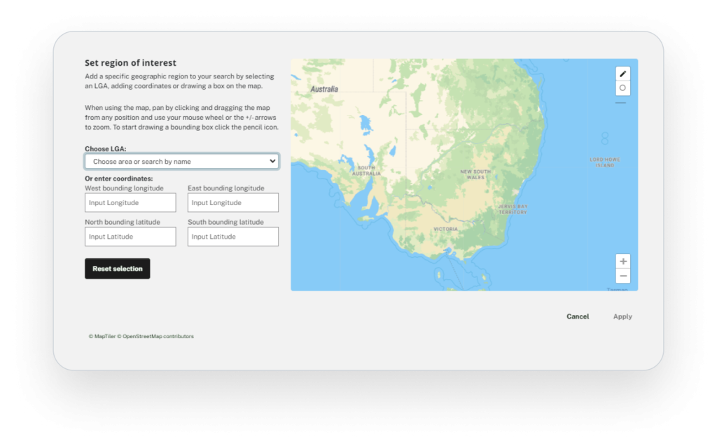
The second, ckanext-spatial, has two main functionalities. It helps CKAN understand a location associated with a dataset, for instance, a pair of coordinates, a bounding box for the dataset extent, or an arbitrary polygon. These geometries are then indexed, allowing users to perform spatial searches for datasets that fall within an area of interest. In addition, it includes harvesters that allow for the importation of common geospatial metadata formats, making them discoverable as CKAN datasets.
Beside the functionality provided by these two extensions, CKAN’s great flexibility and extensibility means that more powerful features can be easily integrated with other geospatial tools. For example, importing or exporting CKAN datasets to geospatial catalogues built with TerriaJS, publishing geoservices with GeoServer, or leveraging the PostGIS geoprocessing capabilities to process data.
Link Digital helps organisations use geospatial tools to improve their data management
Link Digital can tailor a reliable, cost-effective solution to the challenges of better managing and sharing data, both externally and internally, including getting the most out of CKAN’s geospatial data related extensions and integrating the software with more powerful geospatial tools. Examples include:
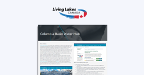
Columbia Basin Water Hub
The Columbia Basin Water Hub is an open data portal developed by Living Lakes Canada (LLCA), a non-government water stewardship organisation with over 20 years of experience protecting freshwater in Canadia’s Columbia Basin region. It collects, catalogues and makes accessible new and historical data, including geospatial and spatial data, for decision-makers, researchers, students, professionals, and the public.
Canadian Watershed Information Network
Managed by University of Manitoba’s Centre for Earth Observation Science, the Canadian Watershed Information Network (CanWin) is an internal data management platform to collect and manage climate data, including geospatial data, and analyse and share it with researchers. Link Digital overhauled the existing CKAN-based platform to facilitate greater data storage capability, improved search efficiency, and new data visualisation tools, including the use of geospatial data, to enable researchers to tell more complex stories about their work.
Pacific Data Hub
Overseen by the Pacific Community, the Pacific Data Hub is the most comprehensive data collection of relevance to the 22 Pacific Island nations and territories. It allows data to be searched by country or subject and presented in different visual ways, including geospatially.
SEED Portal
The New South Wales Government’s Sharing and Enabling Environmental Data (SEED) portal is designed to better categorise and share the State’s environmental data with the public. SEED allows its users to define a geographic boundary for datasets, which assists in filtering data searchers by location, and to view data geospatially in map form and as layers from datasets.
Get in touch
Do you have a data project that needs to present and explore information from geospatial data? If so, please get in contact and tell us about your project, and one of our data experts will be in touch.