The schema required for describing geographic information and services by means of metadata, ISO19115, is maintained by the International Standards Organisation. Within Australia and New Zealand this is approved with minor amendment by Standards Australia and Standards New Zealand. The current approved standard for AU and NZ is AS/NZS ISO 19115.1:2015, which is recommended for use by ANZLIC – the Spatial Information Council, the peak intergovernmental organisation for the collection, management and use of spatial information in Australia and New Zealand.
Link Digital’s early work with ISO19115 sought to capture and validate relevant metadata within a data portal for the New South Wales Office for Environment and Heritage. This work was conducted in 2015 and mapped only the most important fields against an earlier version of the ISO19115 standard, within a custom metadata extension for CKAN. The work was subsequently expanded and improved by mapping a more complete set of fields within the ckanext-scheming extension.
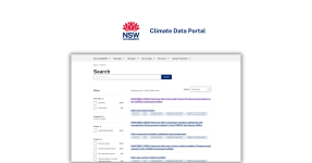
In 2022, we completed the third iteration of our work with ISO19115 on two sites for the then NSW Department of Planning and Environment (now known as the Department of Planning, Housing and Infrastructure or DPIE): an internal data register (IAR), and the Government’s central resource for Sharing and Enabling Environmental Data or SEED open data portal. We worked with the NSW Government to ensure that the geospatial datasets in both the IAR and SEED were compliant with the changes in the standard prescribed in the latest ANZLIC endorsed version. This makes these datasets easier to find and use and makes the catalogues themselves interoperable to the level of current best practice.
Link Digital creates its own validator tool
One challenge we faced in the most recent effort was the lack of a validator that works with AS/NZS ISO 19115.1:2015. Link Digital solved this problem by creating our own validator tool, very similar to this one. The validator takes Extensible Markup Language (XML) – the markup language that provides rules to define any data – as an input and checks whether its adheres or not to the latest standard based on the most up-to-date guidelines for this standard.
Ckanext-scheming extension
This required us to infer requirements and implement a validator directly from the standard’s specification. We did this before implementing the schema to ensure that it would be compatible with the new standard. Complexity within the standard required a careful observance to conditional elements and nested structures. This task would have been very difficult without the use of the ckanext-scheming extension, which has strong support for nested structures. While it is not currently available as a stand-alone extension, it could in theory be reused on other internal and external portals that adopt the same standard.
The value
Adoption of the latest metadata standards for describing geographic information ensures a higher level of interoperability between data portals, providing more value to end users by strengthening the whole ecosystem of geospatial data providers. With the work to map the ANZLIC-endorsed version of ISO19115 for CKAN-based data portals completed, along with a complimentary validator in place, our clients can already register and validate geospatial datasets on three of the NSW Government portals we support. Those are the Planning Data Portal, SEED and an Internal Asset Register used by DPIE. This is great news for other agencies in Australia and New Zealand that wish to comply with AS/NZS ISO 19115.1:2015 within their own CKAN based data portals.
Link Digital believes that the journey of a single aspect of a data catalogue’s maturity, is a good demonstration of the value we provide to our clients when employing our product development methodology over the long-term service life of a managed services agreement.
Get in touch
If you would like to learn more about CKAN and how you can comply with ISO19115 within your own data portal, please get in touch.