GIS and CKAN
A Geographic Information Systems (GIS) capable portal is an on-line data repository that enables users to store, search for, access, download and share quality geospatial data sets, as well as other data.
CKAN – the Comprehensive Knowledge Archive Network – is robust open source software with a global reputation for building data portals, including those that host geospatial data. CKAN’s abilities come into play almost as soon as it is deployed and hosted on a web server. But it’s functionality in relation to GIS data can be greatly increased by a variety of extensions that integrate in a seamless manner with a user’s existing data and digital set up and allow for sophisticated GIS data visualisation and mapping.
Let’s look in more detail at what a CKAN powered GIS capable data portal can do and the value it can add to your data operations. This includes some of the CKAN extensions specifically designed to work with geospatial data. We will also examine some examples of Link Digital’s work for clients in this space.
Table of contents
What can a GIS-capable data portal do?
Geospatial data is any data that has a geographical location component. This encompasses a wide variety of data types: maps, satellite imagery and remote sensing data, and what are known as ‘vector data sets’, visual data representations that describe the shape and location of features such as natural landmarks, buildings, and administrative boundaries – anything from maritime fishing zones to local government areas and different levels of voting electorates.
A GIS capable portal is an online web application designed to make these data sets easier to catalogue, search for, access, download, understand and share. They can be public facing or for internal use or combine both interfaces. Some data portals are designed for GIS data only. One example is Digital Twin Victoria, a platform that gathers a large amount of 2D, 3D and live data about the Australian state of Victoria’s built and natural environment and makes it available for analysis and sharing. But far more common are data portals that are GIS capable, that is they host geospatial data along with other data types. This is because, while geospatial data is valuable, other datasets are usually needed to make sense of it, perhaps a report that includes an explanation of what the GIS data is, the collection methods and how it might be used, or tabula data that cannot be visualised on a map.
GIS capable data portals are an essential tool for researchers, government agencies, businesses, and not for profits that use geospatial data in their day-to-day operations. They make geospatial data storage, discovery and sharing easier and more efficient. And they can enable collaboration and foster more informed decision-making across fields as diverse as urban planning, environmental management, demographic analysis, overseas development, and natural disaster response, to name a few.
Why CKAN is the ideal foundation for GIS-capable data portals
Creating one centralised data management platform using CKAN can have a transformative impact on an organisation, not only by enabling easier and more efficient and accountable data sharing, but by reducing risk of error due being able to register, update and refine datasets for a single point of truth.
CKAN data portals encourage cross-organisation and cross-jurisdiction data sharing in a secure manner. Its custom designed application programming interface integration makes it easy to import data from other services at regular intervals, including legacy data systems. Enhanced security controls include the ability to limit access to selected datasets by setting group and individual permissions. They also allow for version control and audit trails, so any changes can be tracked, enabling data accountability and traceability.
CKAN and GIS components
As part of empowering applications and those who use them to produce trustworthy analysis and fine data and information, CKAN is a natural fit for data portals that include a geospatial data component including:
● Advanced metadata and cataloguing to organise and structure internal data.
● Advanced search functionality, allowing users to search for geospatial datasets by keywords and tags, or by theme, region and topic.
● Application programming support for developers to build GIS applications or integrate with a wide range of GIS related software tools.
● Support for common GIS download formats: Shapefiles (a vector data file format used for geospatial analysis), GeoJSON, and Keyhole Markup Language (an XML software language mainly used on geographic visualisation, such as annotating maps and images).
● Interactive visualisations to improve data accessibility for technical and non-technical audiences. CKAN can also enable individual geospatial visualisations to be embedded on external websites.
Turbo charging GIS data sharing with CKAN extensions
CKAN’s basic functionality in relation to GIS data can be vastly increased through a large range of extensions. These include:
ckanext-spatial
Specifically used to operationalise searching for geospatial data by helping CKAN understand a location associated with a dataset, for example a pair of map coordinates. These are then indexed allowing users to perform spatial searches for datasets that fall within an area of interest. Ckanext-spatial also includes harvesters for importing common geospatial metadata, such as ISO 19115, ISO 19139 and Catalog Service for the Web.
ckanext-geoview
Contains plugins to enable users to access previews of geospatial files in CKAN. Along with ckanext-spatial, this is the most used extension in Link Digital’s GIS related toolbox.
ckanext-mapviews
Enables the creation of regular and choropleth maps to enhance data comprehension within CKAN. Choropleth maps are a type of thematic map where geographic areas are shaded or coloured in proportion to the value of a specific variable, for example, flood risk or election outcomes.
ckanext-harvest
Provides a common harvesting framework for CKAN extensions. This allows for the automatic collection of metadata from other data catalogues and sources and offers CLI and WUI for managing harvesting tasks involving geospatial data.
In the area of data quality and workflow ckanext-validation enables data validation and reporting capabilities for tabular data in CKAN portals, some of which is geospatial. While ckanext-datarequests allows users to ask for datasets that are not already published within CKAN, including geospatial data. I
Use cases on GIS-capable data portals by Link Digital
Link Digital is one of the few global companies that can provide end-to-end service surrounding data publishing on CKAN. This includes building world-class GIS-capable data portals.
The Pacific Data Hub
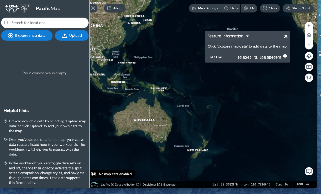
Overseen by the Pacific Community, the Pacific Data Hub is the most comprehensive data collection of relevance to the 22 Pacific Island nations and territories, and allows data to be searched by country or subject and presented in different visual ways, including geospatially. For example, the site contains an interactive map of the Pacific region that finds geospatial data on the Hub and shows it in map form. Users can explore it to find related datasets, as well as add data to it. In relation to population data, essential for everything from disaster risk assessment and response to infection disease control to coastal fisheries management, the Hub’s features include population maps that take actual or projected population data and represent the spatial distribution on a continuous grid surface. The Hub’s Food Trade Database delivers interactive trade data on food and beverage commodities across the Pacific, which can also be viewed geospatially.
Canadian Watershed Information Network (CanWin)
Managed by University of Manitoba’s Centre for Earth Observation Science, CanWin is an internal data management platform to collect and manage climate data, including geospatial data, and analyse and share it with researchers. Link Digital overhauled the existing CKAN-based platform to facilitate greater data storage capability, improved search efficiency, and new data visualisation tools, including the use of geospatial data, to enable researchers to tell more complex stories about their work.
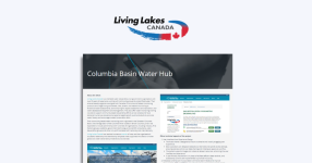
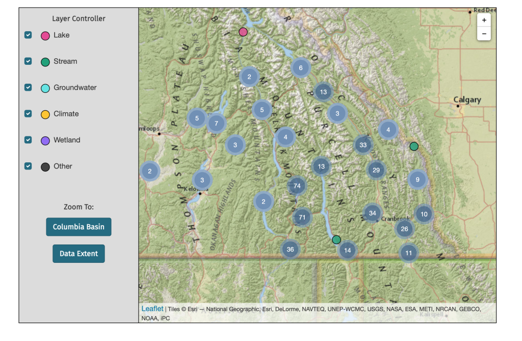
Columbia Basin Water Hub
The Columbia Water Basin Hub is an open data portal developed by Link Digital and Living Lakes Canada, a non-government water stewardship organisation with over 20 years of experience protecting freshwater in Canada’s Columbia Basin region. The Hub collects, catalogues and makes accessible new and historical data, including geospatial and spatial data, for decision-makers, researchers, students, professionals, and the public. A good example of the Hub’s functionality is this sophisticated map feature that enables users to search for datasets geographically, as well as individually and by group.
Conclusion
Link Digital’s global team of CKAN experts can create a customised GIS-enabled data portal to align with your organisation’s unique needs. This includes helping to maximise CKAN’s functionality and versatility in geospatial data by utilising its wide array of extensions.
Whether your aim is to create an online data repository to more efficiently catalogue and share geospatial internally, externally, or both, a Link Digital CKAN-powered portal can facilitate greater data exploration and visualisation. This makes your geospatial data more discoverable and easier to interpret and use, promotes greater improved data-driven decision-making and maximises collaboration.
Not only can a CKAN data portal be easily scaled up or extended to meet evolving data needs, being open source means organisations can avoid license fees and vendor lock-in. This makes it more accessible and cost-effective, especially for small to medium-sized organisations and businesses. It also means users maintain the rights to their data and metadata.
Let’s chat
Do you have a data project that involves geospatial data? If so, I’ll be happy to connect you with our experts. Get in touch.